AI That
Builds Smarter Cities
Smart road monitoring, traffic optimization, and urban flood prediction — Indika AI builds infrastructure AI that reduces maintenance costs, improves public safety, and future-proofs cities.
Infrastructure AI
Applications
 Energy AI
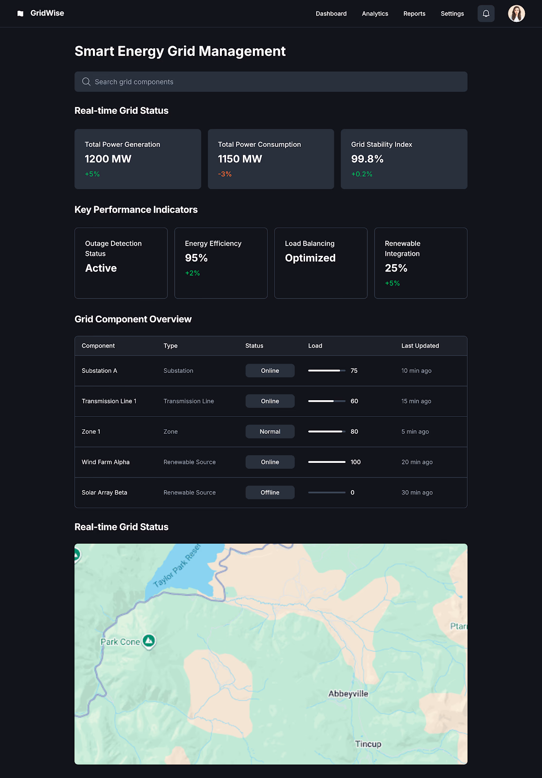
AI for Smart Energy Grids
Optimizes power distribution, load balancing, and outage detection for city-wide electricity grids.
 Urban AI
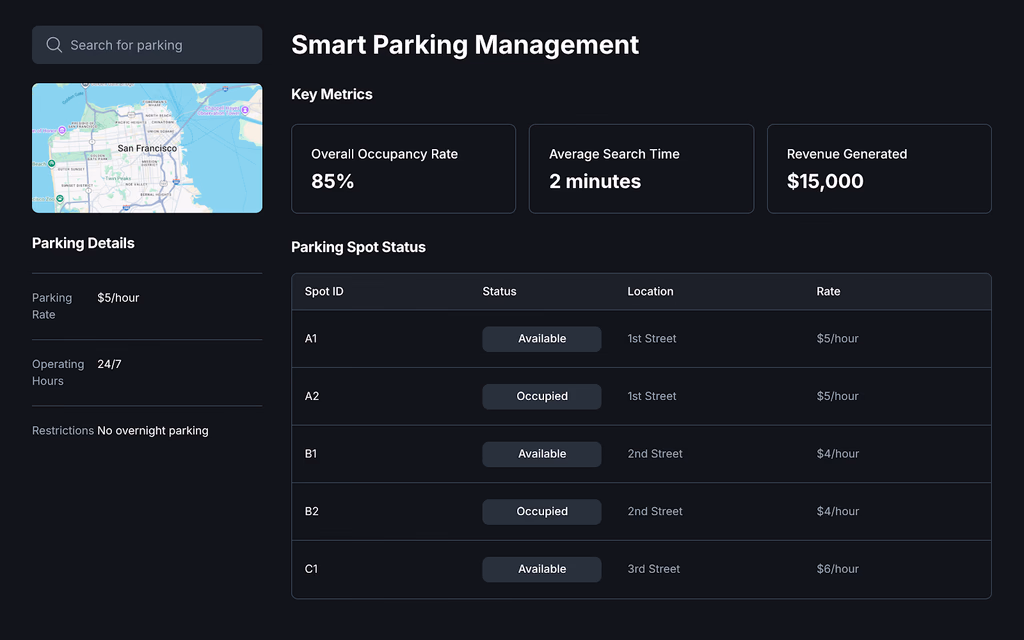
AI for Smart Parking Management
Real-time detection of vacant spots via cameras & IoT sensors, guiding vehicles to reduce search time.
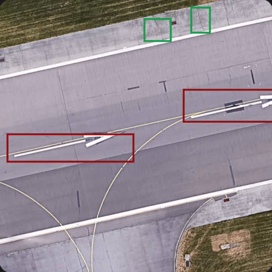 RoadGPT
AI-Based Airport Runway Assessment
Custom solution for analyzing runways and surrounding roads in airports using RoadGPT AI agent.
 Safety AI
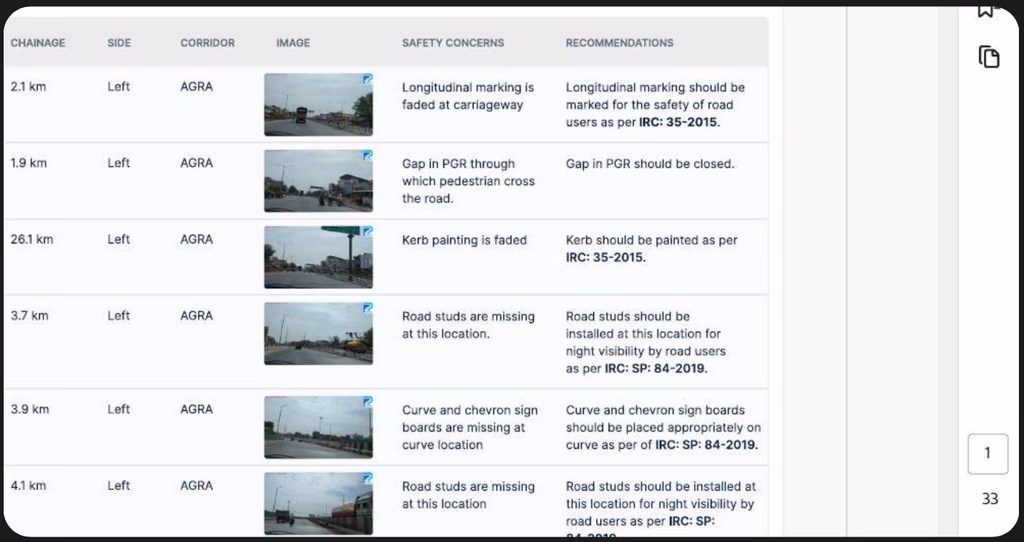
AI-Based Road Safety Audit
Road safety analysis conducted across highways for accident-prone zone identification and planning.
 Climate AI
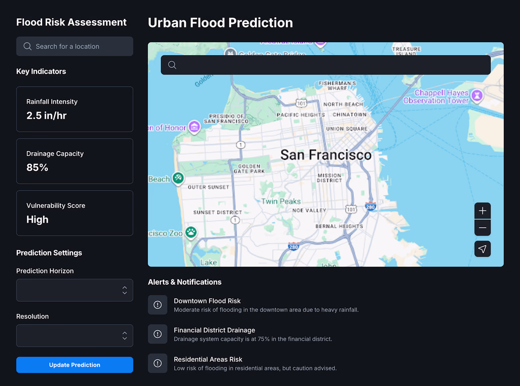
AI-Driven Urban Flood Prediction
Analyzes weather, terrain, and drainage data to predict and prevent urban flooding risks.
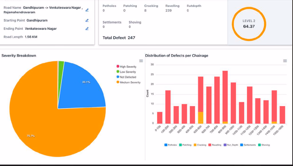
 Road AI
AI-Powered Road Asset Management
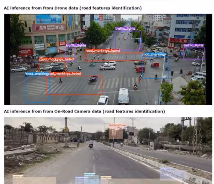
AI layer for managing road data collected via drones, satellites, and on-road cameras to update RAMS.
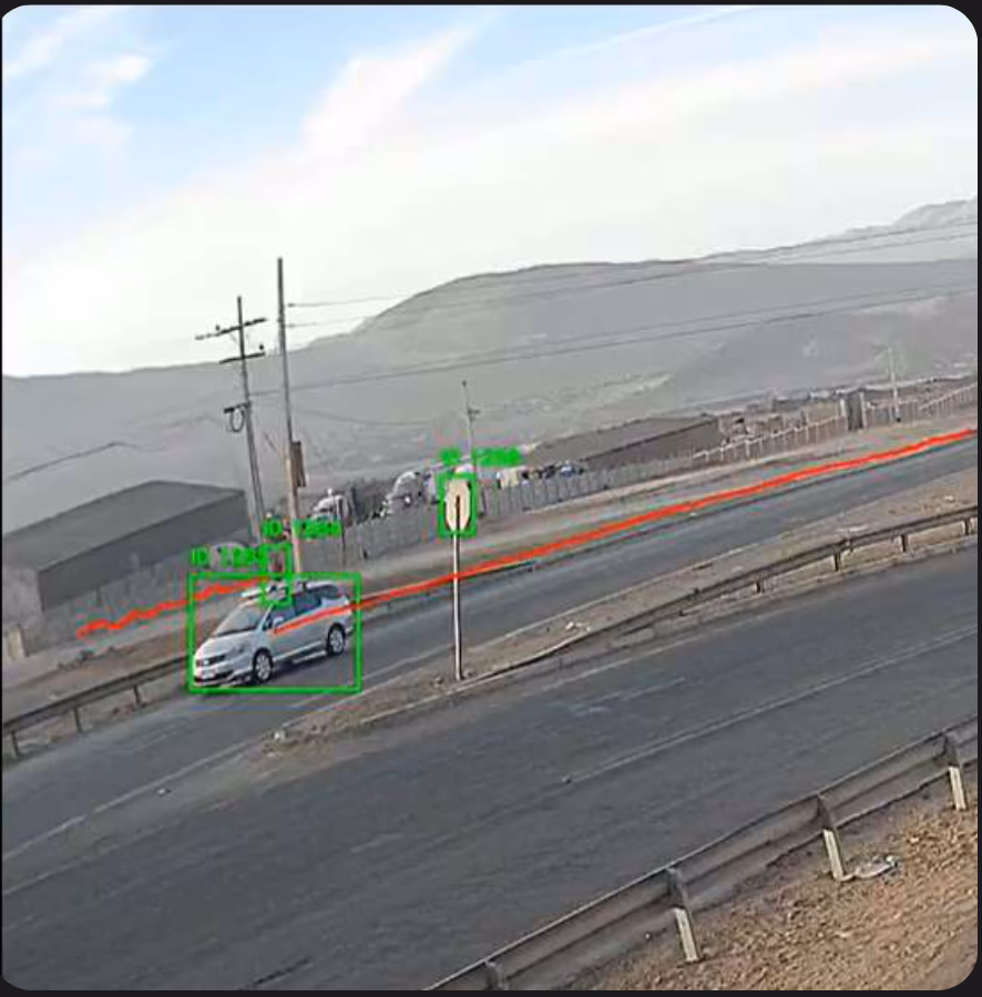 Traffic AI
AI-Powered Traffic Survey
Automated vehicle and pedestrian traffic analysis using object detection and tracking via CCTV or dashcams.
 IoT AI
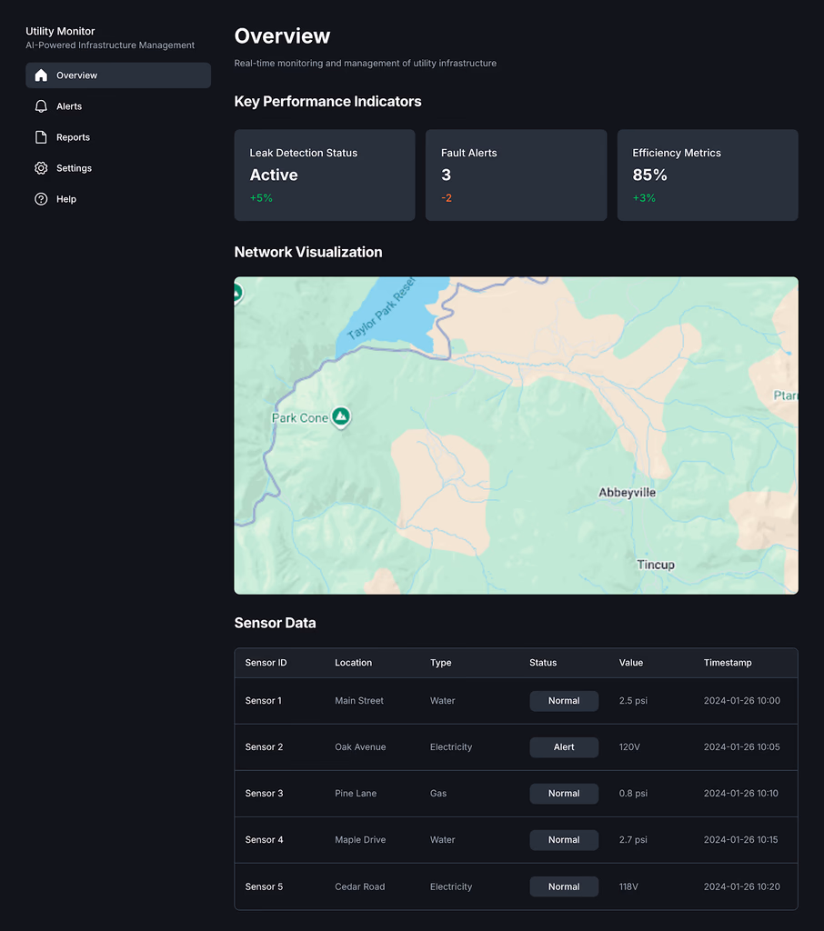
AI-Powered Utility Infrastructure Monitoring
Detects leaks, faults, and inefficiencies in water, electricity, and gas pipelines via sensors & AI.
 Smart City
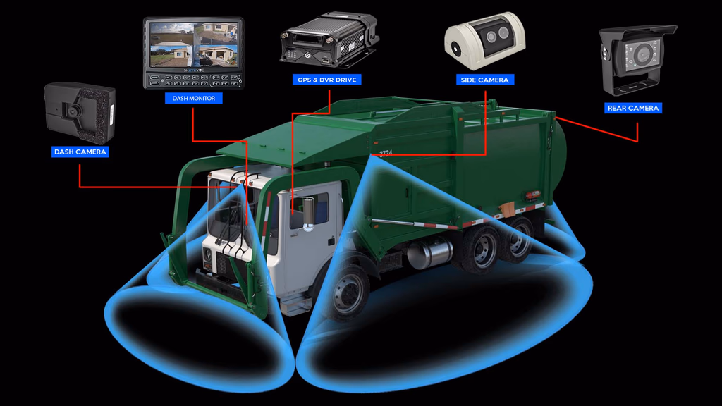
Automated Road Survey via Garbage Trucks
Municipal waste vehicles equipped with dashcams collect road condition data daily
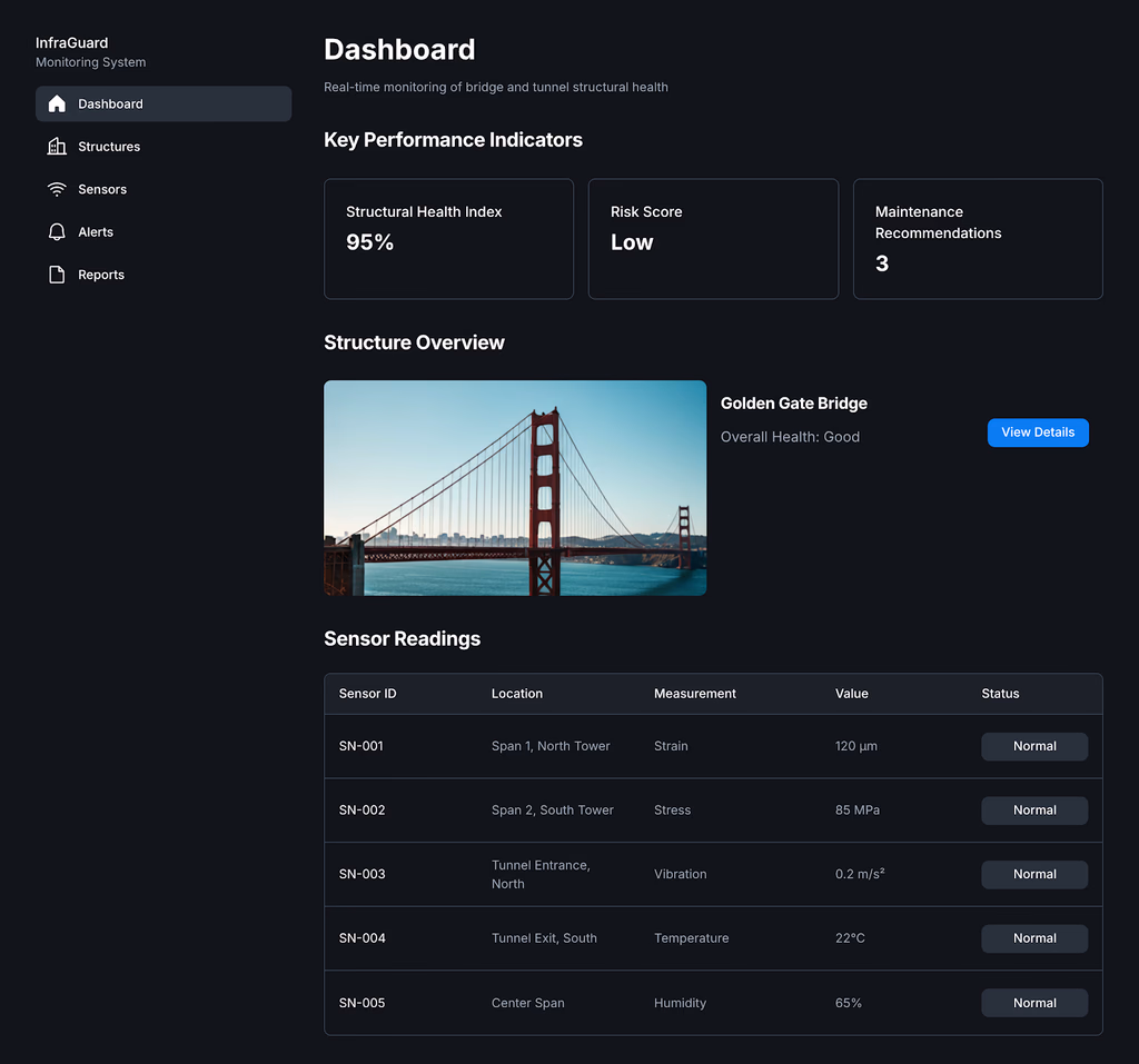 Structural AI
Bridge & Tunnel Structural Health Monitoring
AI + IoT sensors track stress, vibrations, and wear in critical structures
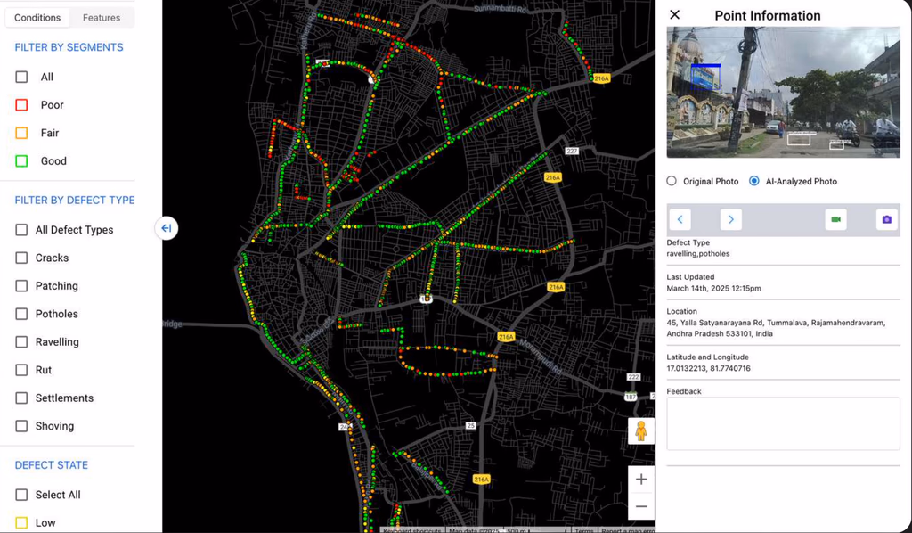
 GIS AI
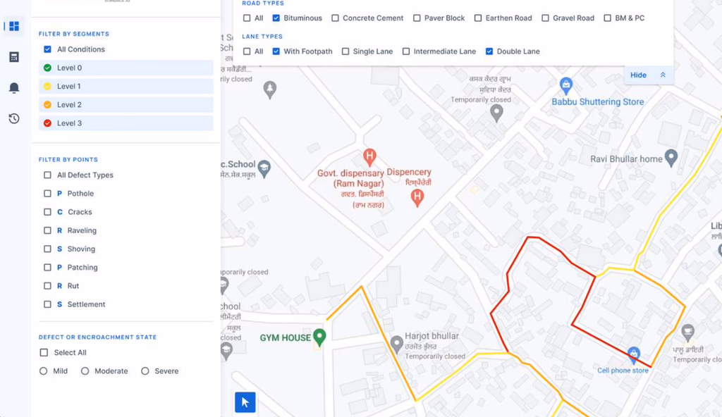
Centralized Road Monitoring Dashboard
GIS-based dashboard to visualize road conditions, track repairs, access reports
 City AI
City-Wide AI Road Monitoring
Full city road condition and furniture analysis using AI for better road maintenance
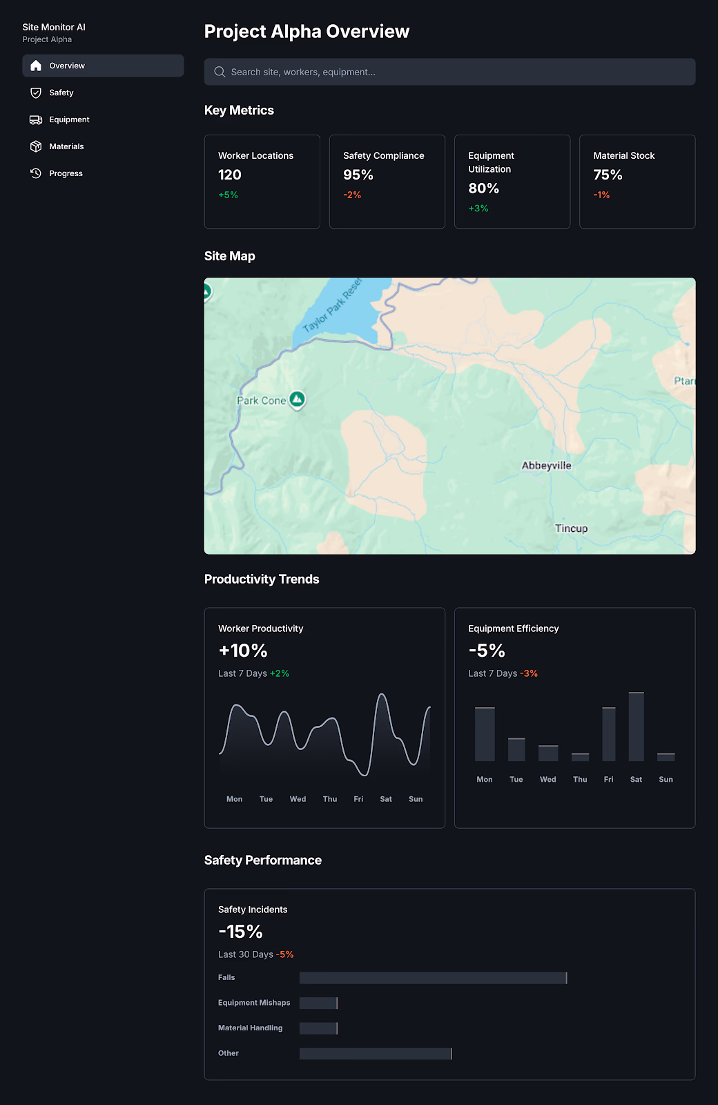 Site Safety
Construction Site Monitoring AI
Tracks worker safety, material usage, and equipment activity in real time
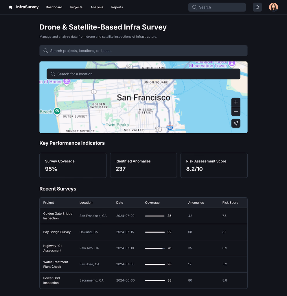 Drone AI
Drone & Satellite-Based Infra Survey
Uses drones/satellites for large-scale inspection of roads, bridges, and urban layouts
 Road AI
Pavement Condition Assessment
AI-based system to assess and classify road surface conditions using video/GIS data
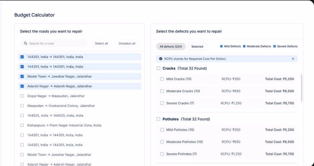 Budget AI
Predictive Road Budget Calculator
Estimates and predicts road repair/maintenance costs using defect data
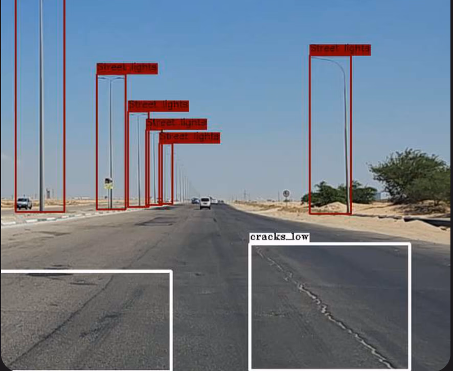
 Defect AI
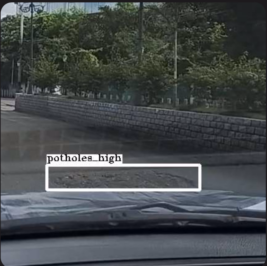
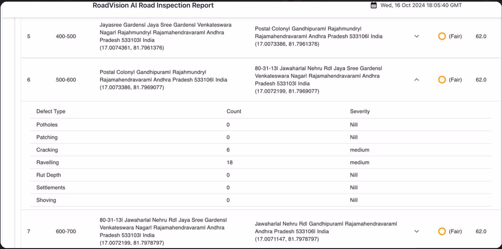
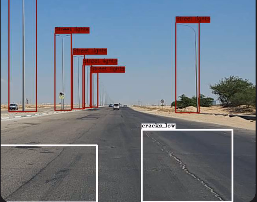
Road Defect Detection & Classification
Detects cracks, potholes, and surface issues with AI to assess root cause
 Compliance AI
Road Furniture Detection for Compliance
Detection of road-side assets as per national standards (ASTM, IRC)
 Mapping AI
Road Inventory Digitization
AI detects and maps all road-side assets (furniture, signage, etc.)
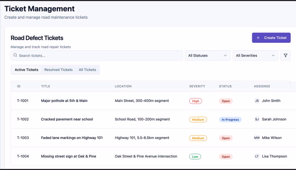 Ops AI
Road Task Management System
Enables task assignment, status tracking, and collaboration among road management teams
 RoadVision
Smart Data Upload & Processing
Smartphone survey data auto-uploaded to RoadVision Cloud for instant report generation
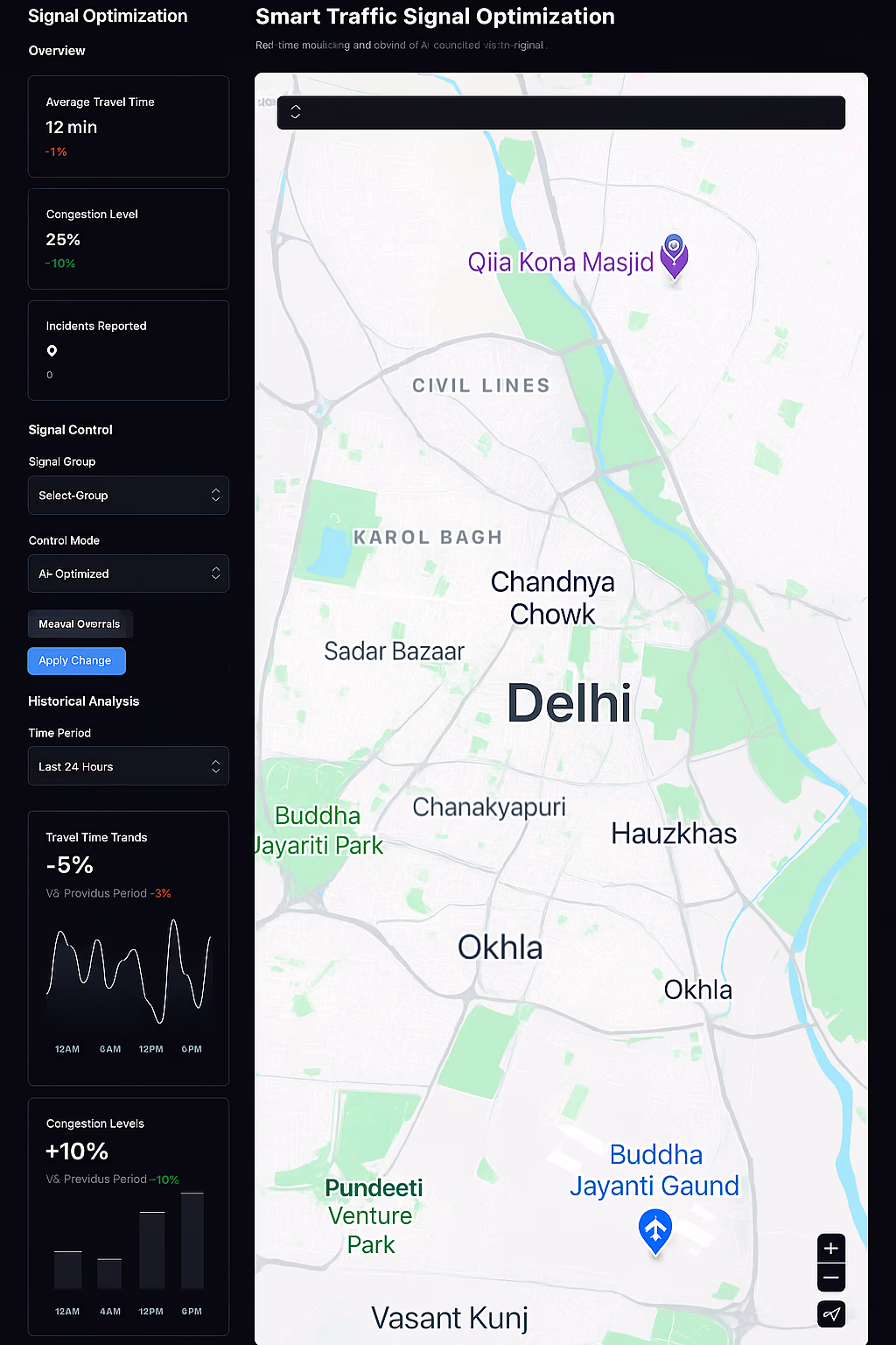 Traffic AI
Smart Traffic Signal Optimization
AI analyzes live traffic to dynamically control signal timing
 Smart City
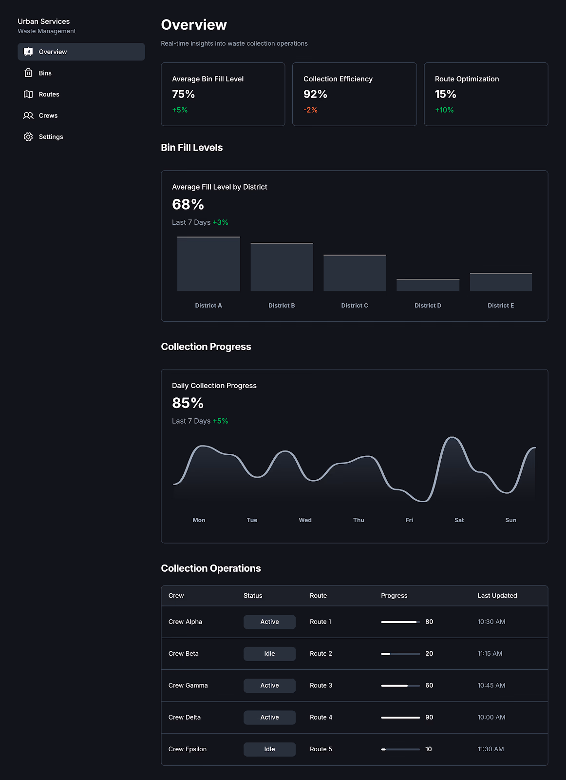
Smart Waste Collection Optimization
AI predicts waste bin fill levels and optimizes collection routes
Ready to Deploy AI Across Your
Infrastructure Operations?
Common Questions
Our edge and cloud-based computer vision pipelines apply dynamic semantic segmentation and object detection to classify road surface anomalies, inventorying assets like signage and streetlights with geotagged timestamps at line speeds.
Yes, our smart infrastructure platforms are engineered to continuously ingest live water level metrics, weather telemetry, and historical terrain data into optimized predictive time-series models to alert civic authorities before threshold breeches occur.
We leverage continuous RLHF mapping workflows where GIS specialists and civil engineers audit aerial inference boundaries, correcting label mapping to maintain strict conformance to national engineering codes (ASTM, IRC).